
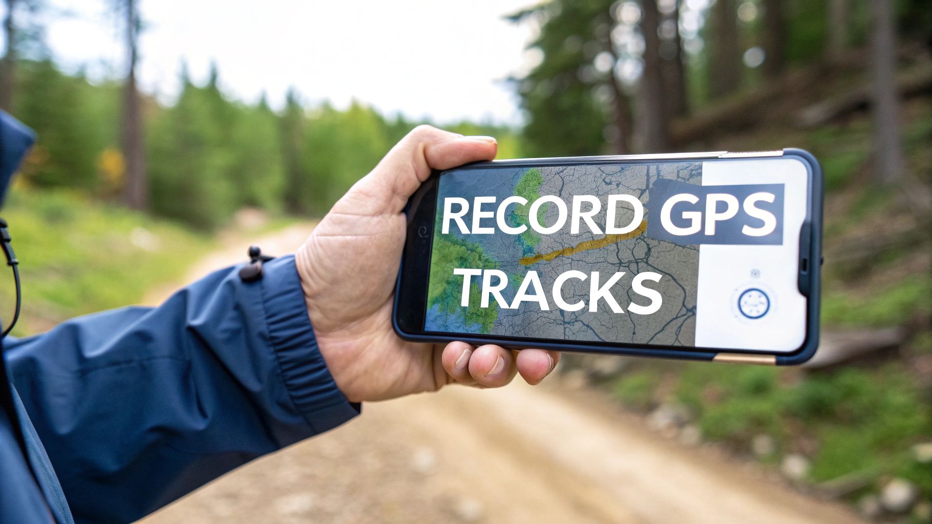
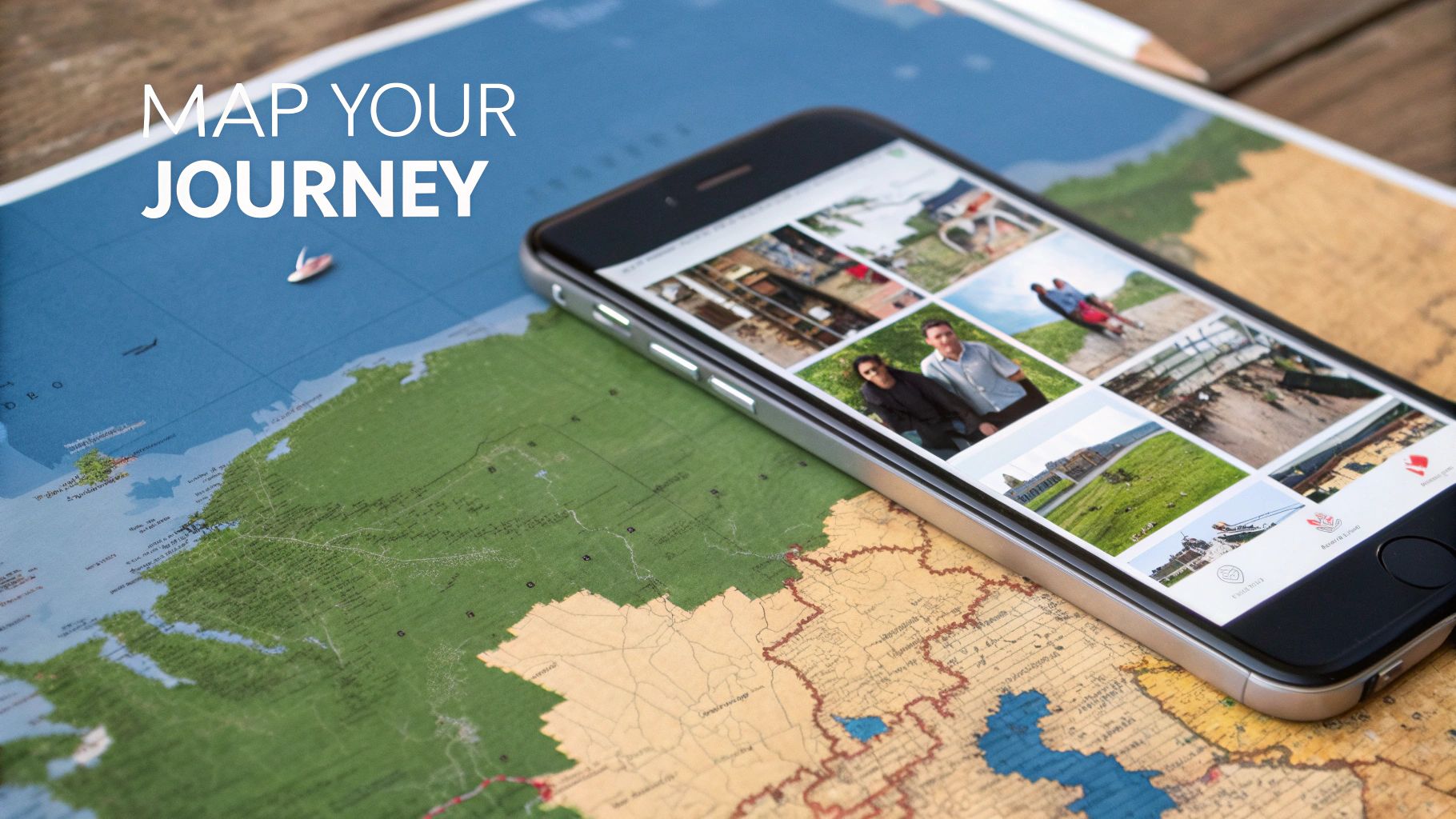
So, can you actually record a proper GPS track on your iPhone? The short answer is yes, but not right out of the box. If you want to log the detailed route from a hike, a bike ride, or even a scenic drive, you're going to need a dedicated app from the App Store. Think of these apps as the key to unlocking a feature your phone was always capable of.
Your iPhone Is a Powerful GPS Tracker
Make no mistake, your iPhone is already a fantastic GPS device, keeping a constant eye on its own location. But there's a world of difference between the background location history Apple keeps for its own services and a clean, usable GPS track that you can save, analyse, or share with friends.
Apple’s own "Significant Locations" feature (found under Settings > Privacy & Security > Location Services > System Services > Significant Locations) does log the places you visit often, but it's not built for creating a continuous path of your journey. It’s more of a general record to help with personalised suggestions in Maps or Photos. To really capture the winding path of a forest trail or the exact route of a city tour, you need an app that can constantly sample your location and string those data points together into a coherent line.
Why You Need a Dedicated App
This is where a third-party app becomes essential. It unlocks the true potential to record gps tracks on an iPhone by offering specific tools that iOS on its own just doesn't provide.
Here’s what you get:
- Continuous Recording: These apps are built from the ground up to log your position every few seconds, creating a highly detailed and accurate line of your movement.
- Data Export: Once you're done, you can save your route in universal formats like GPX or KML. This means you can easily use your track in other mapping software on your computer.
- Enhanced Features: Many apps go a step further, letting you add photos, notes, or important waypoints directly onto your track as you go.
This kind of functionality is especially useful in places with high smartphone adoption. Take the Netherlands, for example, where over 90% of the population uses a smartphone. That's millions of iPhone users who are already carrying a powerful GPS logger in their pockets every day. You can find more detail on the smartphone penetration rate in the Netherlands at Statista.com.
Finding The Right GPS Tracking App For Your Needs
The App Store is a sea of options, and picking the best app to record gps tracks on your iPhone really boils down to what you’re doing. A multi-day trek through the wilderness demands something very different from a casual city walk, so figuring out your main activity is always the first step.
A serious hiker, for example, needs an app with solid offline map support and low battery drain. But if you’re just documenting a holiday stroll, you’ll probably care more about a clean interface and easy social sharing. Getting this right from the start saves you from picking a tool that’s too complicated for a simple job, or a basic app that lets you down when you're off-grid.
There's no doubt these apps are popular. In the Netherlands alone, the numbers are huge. By the end of Q1 2025, Google Maps on iOS hit 5.1 million weekly active users, and travel logger Polarsteps grew its user base to over 509,000. You can dig into more data on Dutch app engagement on SensorTower.com.
This visual guide breaks down the simple process for picking the right app for what you need.
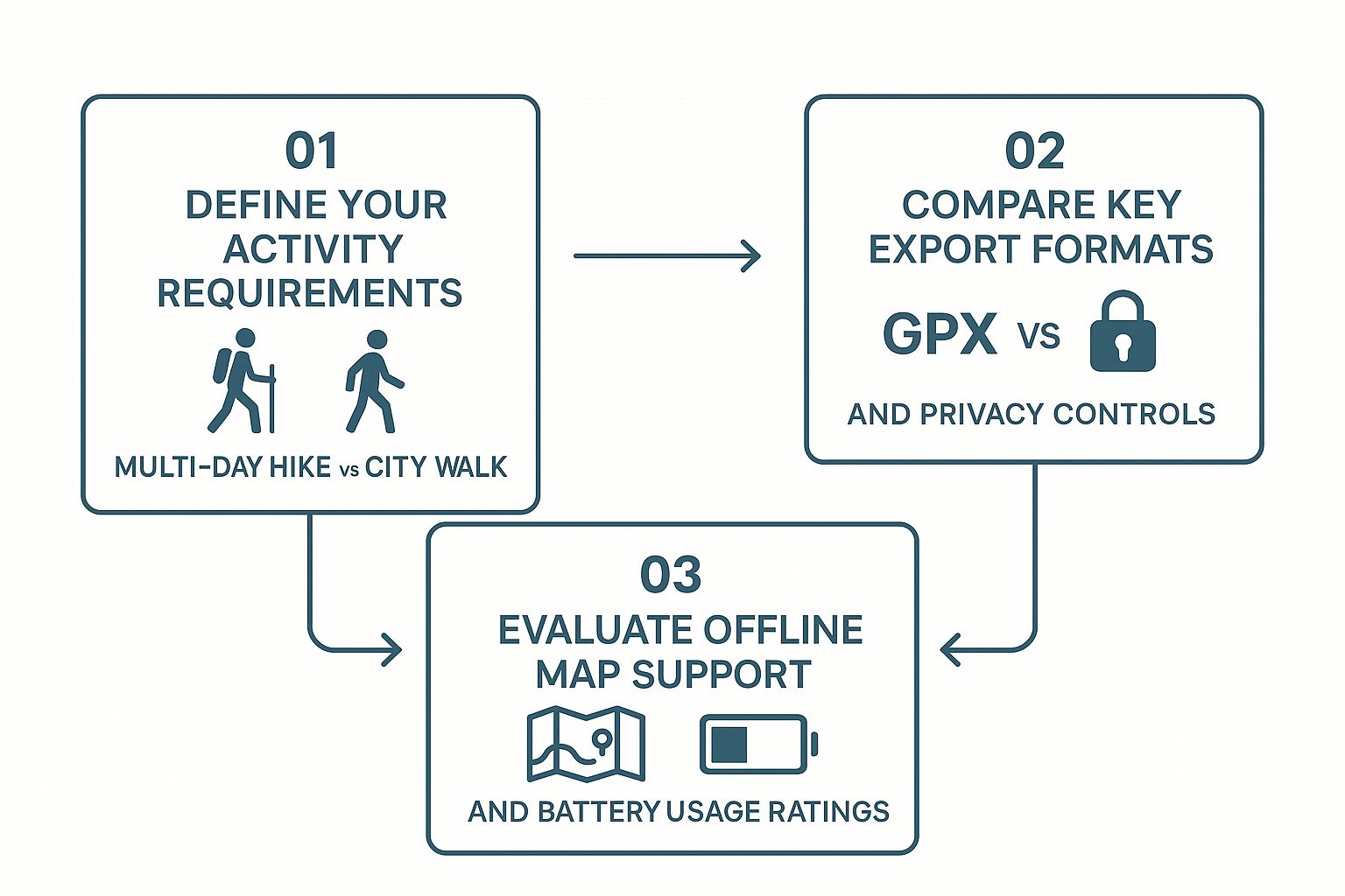
As you can see, your activity should always drive your decision on features like export formats and battery performance.
Key Features To Compare
Once you know what you’ll be using the app for most, zoom in on these critical features. It’s what separates the good apps from the great ones.
- Export Formats: Does the app support universal formats like GPX or KML? This is a big one. GPX is the gold standard for raw track data—perfect for hikers and cyclists who want to analyse their performance. KML is what you want for viewing your route in Google Earth.
- Privacy Controls: Your location data is sensitive. A good app gives you fine-grained control over who sees your tracks, from keeping them completely private to sharing them publicly.
- Offline Capability: If you’re heading anywhere without a mobile signal, make sure the app lets you download maps for offline use. Your iPhone’s GPS will still work without data, but the map layer itself won't.
Pro Tip: Check the app’s update history in the App Store. Frequent updates are a great sign. It usually means the developer is actively fixing bugs and adding new features based on what users are asking for.
It's also worth looking at specialised fields, like these drone tracking apps, which often push the boundaries with advanced mapping and tracking features.
Comparison of Top GPS Tracking Apps for iPhone
To make your choice a little easier, I’ve put together this table comparing some of the best options out there. This should help you quickly see which app aligns with your needs, whether you're hitting the trails or just logging your travels.
| App Name | Best For | Key Features | Export Formats | Price |
|---|---|---|---|---|
| Strava | Running & Cycling | Social features, segment competitions, detailed performance analytics | GPX | Freemium |
| Gaia GPS | Hiking & Backcountry | Offline topo maps, route planning, extensive map layers | GPX, KML, GeoJSON | Freemium |
| Polarsteps | Travel Logging | Automatic journaling, photo integration, beautiful trip summaries | GPX (Premium) | Freemium |
| AllTrails | Trail Discovery | Massive library of curated trails, community reviews, offline maps | GPX, KML | Freemium |
| GPS Tracks | General Purpose Tracking | Simple interface, customizable recording, extensive data fields | GPX, KML, CSV | Paid |
Each of these apps has its strengths. If community and competition motivate you, Strava is fantastic. For serious outdoor adventures where maps are critical, Gaia GPS is hard to beat. Choose the one that feels like it was built for you.
How to Record Your First GPS Track
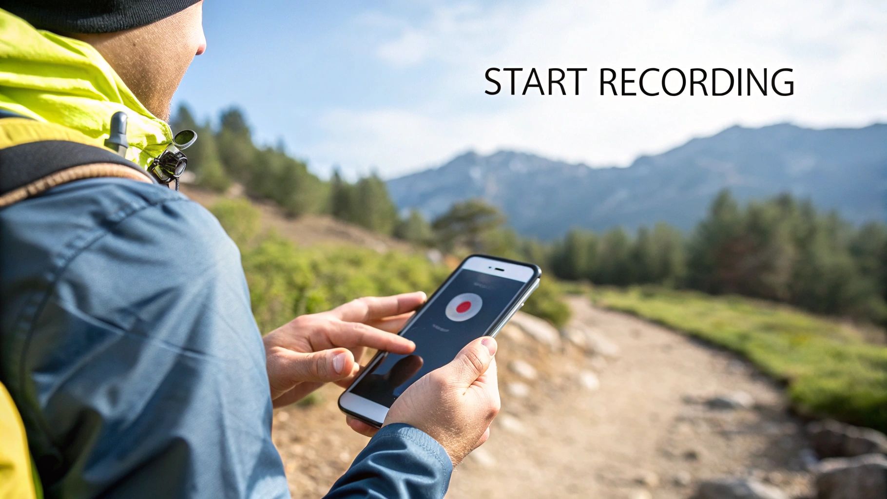
So, you've picked an app. Now comes the fun part: actually getting out there and recording your first route. Capturing a GPS track on your iPhone is pretty simple on the surface, but a couple of key settings can make a massive difference to the quality of your final map.
Getting these right before you start means cleaner data and, just as importantly, less battery drain.
The most critical first step is managing your location permissions. When you first launch the app, your iPhone will ask for access. You'll likely see options like 'Always', 'While Using the App', and 'Never'. If you're planning a long hike and need the app to track you in the background with the screen off, 'Always' is often the way to go. For a shorter run or walk where you'll have the app open, 'While Using the App' works perfectly and is a better choice for privacy and battery life.
Preparing Your App for Recording
Before you hit that big 'Start' button, it's worth spending a minute in the app's settings. Most decent GPS tracking apps let you choose different recording profiles or modes, each tailored to a specific activity.
Think about it: a 'Hiking' profile might check your location every 10 seconds to catch all the twists and turns on a trail. A 'Driving' profile, on the other hand, might only need to log a point every 30 seconds since your path is much smoother. This small tweak is the secret to balancing the detail of the gps tracks your iPhone records against its battery consumption.
Here's a quick pre-flight checklist:
- Choose a Profile: Match the activity to what you're doing—walking, cycling, running, etc.
- Check Map Layers: If you're heading into the wilderness with no signal, make sure you've downloaded the offline maps for that area beforehand. Trust me, you'll be glad you did.
- Customise Display: Set up the screen to show you the data you care about, whether that's distance, current elevation, or average speed.
Capturing Your Journey Effectively
Once you're recording, start thinking like a mapmaker. You're not just creating a line; you're adding context to your adventure and telling a story.
A classic mistake is leaving the track running while you stop for a long lunch break. This creates a messy "spider web" of GPS points right in the middle of your route and throws off your average speed. Get into the habit of using the pause button whenever you stop for more than a few minutes. It keeps your track line clean and your stats accurate.
Here's a habit that pays off: add waypoints at key moments. See a stunning viewpoint or a confusing trail junction? Drop a pin and maybe even attach a quick photo from your iPhone. This transforms a simple line on a map into a rich, detailed story of your day out.
Finally, when you're done, take a moment to save and name your track properly. Don't just leave it as "Track 001". A descriptive name like "Vondelpark Loop - Afternoon Walk" makes finding, exporting, and sharing your gps tracks from an iPhone a whole lot easier down the line.
Getting Your GPS Data Out
Once your adventure is over, the GPS track sitting on your iPhone is only useful if you can actually do something with it. Exporting that data is what turns a simple line on a map into a versatile file you can analyse, archive, or share with others. It gives you full control over the data you created.Most good tracking apps will let you export your track in one of two standard formats: GPX (GPS Exchange Format) or KML (Keyhole Markup Language).
Think of GPX as the raw data. It holds your precise route, timestamps, and even elevation, making it the go-to format for uploading to fitness platforms like Strava or for a deep dive into the analytics. KML, on the other hand, is built for visuals. It plays beautifully with Google Earth, letting you see your path in stunning 3D.
How to Export Your Track
Getting the file off your iPhone is usually pretty straightforward. The app’s share function will typically give you several ways to move your recorded gps tracks from an iPhone to another device or cloud service. The process is generally:
- Navigate to your saved track within the app.
- Look for a 'Share' or 'Export' button (often represented by an arrow icon).
- Choose your desired format (e.g., GPX).
- Select a destination from the iPhone's share sheet.
You’ll usually see a few common options:
- AirDrop: Perfect for instantly sending the file over to your Mac or another Apple device.
- Files App: Save the track directly to iCloud Drive, Dropbox, or Google Drive for easy access from anywhere.
- Open In...: This lets you send the file straight to another compatible app on your iPhone. For example, you could open a KML file directly in Google Earth without needing to save it first.
The ability to export is a non-negotiable feature. It ensures your data isn't locked into one app's ecosystem. You created the data; you should be able to take it anywhere you want.
This idea of data portability is vital. For anyone managing different kinds of digital assets, understanding the mechanics behind it is key. We touch on similar principles in our article about exporting dashboard data, which shares some of the same core concepts.
Let's imagine you just finished a tough hike. By exporting the GPX file, you could email it to friends who want to try the same route, upload it to a trail database to help the community, or simply keep it as a digital souvenir of your accomplishment. That flexibility is what makes tracking your routes so powerful in the first place.
So, What Can You Actually Do With These GPS Tracks?
Once you’ve exported that GPX file, the real fun begins. Raw location data is like a blank canvas, waiting for you to turn a simple line on a map into something much more personal and useful.
Think about your last holiday. By merging your GPS tracks from an iPhone with your geotagged photos, you can build an interactive map that tells a story. It doesn't just show the route you took; it pinpoints exactly where you snapped that amazing sunset photo or found that hidden café. It’s a far more engaging way to share your journey with friends and family than a standard photo album.
Analyse Your Performance and See the Terrain in 3D
For anyone who runs, cycles, or hikes, these tracks are a goldmine. A runner can pull their GPX file into an analytics app and see the exact spot on a long run where their pace started to drop. Was it a sneaky incline? Or just a tough section? Now you know what to focus on in training.
Hikers and cyclists can get a whole new perspective by dropping their route onto a 3D satellite map. It's one thing to know you climbed a big hill, but it's another to actually see the elevation changes and the true scale of the landscape you conquered.
Your GPS data is more than just a record of where you’ve been. It's a tool for looking back, understanding your effort, and planning your next adventure.
From Personal Projects to Practical Sharing
Beyond your own analysis, these tracks have some really practical uses. If a friend wants to try a hike you've completed, you can send them the exact GPX file. No more vague directions—they get a proven, safe route to load onto their own device.
This is also great for organising group events. When everyone is literally on the same map, things run a lot smoother. We touch on this same idea in our guide on planning outdoor team-building activities.
You can even take it a step further and contribute your data to community projects like OpenStreetMap, helping to map unrecorded trails for everyone. This kind of crowdsourcing is part of a much bigger picture. The European GPS tracking market is expected to grow from around USD 4 billion in 2025 to over USD 14 billion by 2035, driven by everything from logistics to personal navigation. You can read more about the GPS tracking device market growth on researchnester.com. Your small personal track is a tiny piece of that massive, growing ecosystem.
Common GPS Tracking Questions Answered
Even with a great app in hand, you're bound to have a few questions when you start recording GPS tracks on your iPhone. Let's tackle some of the most common ones head-on. Getting these sorted out early will save you a lot of frustration and help you get much more reliable results.
One of the first worries that comes up is battery life. It's a fair point—running the GPS constantly can be demanding. But modern apps are a lot smarter about managing power than they used to be. Here are some actionable steps you can take:
- Dim your screen: The display is a major power drain.
- Enable Low Power Mode: Go to
Settings > Battery > Low Power Mode. - Close other apps: Prevent background processes from using up energy.
- Use a battery-saving recording profile: If your app offers this, it will reduce how often your location is checked.
Another big question: does GPS work without a mobile signal? The answer is a solid yes. Your iPhone has a dedicated GPS receiver that talks directly to satellites, completely separate from your mobile or data connection. As long as you've downloaded any maps you need for offline use beforehand, your phone can find your position anywhere on the planet.
Accuracy and Privacy Concerns
So, just how accurate are the GPS tracks from an iPhone? For most things like hiking, running, or cycling, the accuracy is more than enough, usually landing within a few metres of your actual location. You might see a few minor wobbles in the data when you're surrounded by tall buildings or under thick tree cover, but for everyday recreational use, the results are consistently solid.
Your location data is incredibly personal. It’s wise to understand what an app does with your information before you start recording. Always review the app's permissions and its approach to data handling.
For anyone building an app that handles this kind of information, earning user trust is everything. That often starts with a comprehensive guide to mobile app privacy policies to ensure everything is handled correctly from the ground up.
Finally, what's the deal with all those data formats? When you go to export your tracks, you’ll likely see options like GPX, KML, and sometimes CSV. Think of GPX as the universal standard; it's perfect for raw route data that you can use in almost any other mapping application. KML is your best bet for seeing your track in 3D on Google Earth. And if you're the type who likes to dig into the numbers with a spreadsheet, learning about the flexibility of CSV exports for your data can unlock a whole new level of analysis.
At WhatPulse, we provide tools that help you understand application and computer usage with a strong focus on privacy. Discover how our analytics platform can provide valuable insights without compromising user trust. Learn more at whatpulse.pro
Start a free trial